

This is the third in a series of articles the Hingham Anchor will be running over the next several months. The series is written by a team of contributors, all residents of Hingham. The “This Is Home” series will focus on a variety of topics about our lives as Hingham residents and engaged citizens. Our hope is that you gain encouragement, and perhaps inspiration, as we all work to maintain Hingham as a vibrant community.
October 14, 2025 Submitted by Art Collins, Courtesy Photos
Art Collins has been Chair of the Board of Directors of the HLCT since 2020
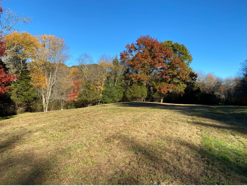
According to the 2020 Hingham Master Plan survey, greenspace was the number two attribute that people said they loved about Hingham, second only to the town’s history. Hingham is fortunate to have 4,571 acres of open space accessible to the public, which makes up 31.4% of the total land area of the town. Much of the space has maintained trails such as Wompatuck State Park, Bare Cove Park, The Trustees (formerly the Trustees of Reservations) properties, town owned conservation properties, and three properties owned and maintained by the Hingham Land Conservation Trust (HLCT), totaling over 33 miles of trails in all. Some of the space has specific recreational uses such as playing fields and the South Shore Country Club.
That is just on the mainland, but beyond the 21 miles of coastline, Hingham is home to five uninhabited islands which are part of the Boston Harbor Islands National and State Park. There are other parcels owned by the town which are not easily accessed but are protected by conservation restrictions and are critical to protecting air and water quality and provide much needed habitat for wildlife. In addition, ten privately owned parcels of land are protected in perpetuity by conservation restrictions and while not publicly accessible, still benefit the public by protecting the environment. These spaces are clearly important to Hinghamites and a big reason many come to Hingham whether to visit just for the day, or to live.
It took a lot of work by many people, generous donations, and some luck for there to be as much open space as there is. Hingham has a long and evolving history of open space preservation, shaped by a tradition of civic engagement and forward-thinking land stewardship. The town’s open space efforts date back to the early 20th century, when prominent families such as the Brewers and Whitneys began protecting large tracts of coastal and forested land for recreation and conservation. During the postwar suburban expansion of the 1950s–70s, local leaders recognized the need to safeguard remaining natural areas. In response, the Hingham Conservation Commission was established in 1965, followed by the founding of the Hingham Land Conservation Trust (HLCT) in 1972. These organizations, along with state agencies and nonprofits, helped acquire and manage lands such as Worlds End, Weir River Farm, Turkey Hill, Wompatuck State Park, Bare Cove Park, Jacobs Meadow, and most recently the Lehner Conservation Area. An example of multiple entities working together to protect open space is the Turkey Hill property which was acquired by the towns of Hingham and Cohasset in the late 1990s and is managed by the Trustees. Both the HLCT and the Cohasset Conservation Trust worked with the towns and the Trustees to help garner support for and raise money for the purchase.
The network of parks, woodlands, coastal access, and trails that exists today reflects decades of public and private collaboration to preserve the town’s ecological, historical, and recreational assets. There is still much more that needs to be done such as connecting open spaces so that wildlife can travel freely, protecting additional land, private landowners letting portions of their property become wild and habitat for native plants and animals. In 2015 Hingham developed a Comprehensive Trails Plan which includes detailed guidance for trail clearing and maintenance, recommendations for trail access, and linking of trails to advance townwide trail networks, but much of it has yet to be implemented. Below are some of the highlights of the open space that residents of Hingham enjoy.
Hingham open space highlights:
The Hingham Land Conservation Trust (HLCT)
The HLCT is an entirely volunteer run organization which has played an important role in acquiring and managing open space as well as educating the public and advocating for conservation. The HLCT’s land holdings have grown through generous donations from local conservation-minded residents. Key early properties include Jacobs Meadow, a 38-acre landscape of fields, stone walls, and pine woods gifted by Helen Burns between 1976 and 1986. Whortleberry Hollow, donated by Suvia Whittemore in 1983, added 13 wooded acres off Cushing Street. Eel River Woods, a 12-acre forest and wetland parcel, was gifted by Mary Niles in 1985.
The “Parklands for the Public” map is HLCT’s flagship guide to Hingham’s open spaces, first published in 1982 by Phil Swanson, Francis Wylie, and John Richardson. It drew inspiration from the Conservation Commission’s 1970 freehand map of 21 areas and has since been updated multiple times: in 1985, 1995, 2003, 2010 (Hingham’s 375th anniversary), and 2017. In 2022, the HLCT began a major modernization of the map, making it fully digitized, and is working to develop it into an interactive map for use on mobile devices. The map currently catalogs and provides descriptions for over 90 open space parcels, including recent acquisitions such as Turkey Hill, Weir River Farm, Triphammer Woods, a 100-acre expansion of Wompatuck State Park, and the 50-acre Lehner Conservation Area. The map serves as both a navigational tool and an educational resource, encouraging residents and visitors to explore Hingham’s coastal views, woodlands, wetlands, and farmland, while highlighting critical conservation efforts that protect watersheds and wildlife habitat. HLCT members can request large-format posters, and printed versions are available at Town Hall and the Hingham Public Library. (Parklands for the Public Map)
The HLCT celebrated its 50th anniversary in 2022 by launching 50 Walks, an interactive online tool that showcases fifty curated walks across Hingham’s public and conserved open spaces. Developed by HLCT board member Don Kidston after extensive on-the-ground research, the tool allows users to search and filter routes by length, difficulty, surface type, and permitted activities like walking, hiking, running, or biking. Walk categories include trail routes, paths, and road segments, rated from easy to difficult, with eight ADAcompliant options and many moderate trails suited for varied ability levels. This wonderful tool enhances public accessibility to Hingham’s thousands of acres of green space by providing clear trail guidance, route variety, and user-focused searchability. (50 walks) Also launched on the 50 th anniversary was the Sally Goodrich Environmental Research Grant program, which is an annual grant that funds research projects to assist in conservation and access to lands in Hingham and surrounding towns. The grant was initiated by a gift from the estate of Sally Goodrich, a founding board member of HLCT, and supplemented by generous donations from HLCT members, many of whom got the opportunity to know Sally and work with her on the HLCT.
Wompatuck State Park
Wompatuck State Park, is a 3,500-acre forested public park spread across the towns of Hingham, Cohasset and Norwell, with over 1,500 of those acres in Hingham. The park is named after Chief Josiah Wompatuck, a 17 th century leader of the Massachusett tribe who deeded much of the surrounding land to English settlers in 1655. Originally forest and tribal land, the area played various roles throughout history. During World War II, it became the site of the Hingham Naval Ammunition Depot Annex. From 1941 to 1965, the military used the site to store and supply munitions to the U.S. Navy. Many of the original bunkers and structures remain scattered throughout the park today, adding an eerie and fascinating historical element for explorers.
In 1969, the land was transferred to the Massachusetts Department of Conservation and Recreation and designated as Wompatuck State Park. Since then, it has developed into a popular destination for outdoor enthusiasts. The park features over 40 miles of trails suitable for hiking, mountain biking, and horseback riding, with a 12-mile paved bike path ideal for families. Camping is also available with more than 250 wooded campsites, some with electrical hookups. Wompatuck also offers fishing opportunities in Aaron River Reservoir and nearby ponds, as well as winter activities like cross-country skiing and snowmobiling. The park’s mix of dense woodlands, streams, wildlife, and remnants of military history provides visitors a unique blend of nature and heritage. Today, Wompatuck State Park stands as a testament to the area’s Indigenous legacy, wartime past, and evolving use as a haven for recreation and conservation in Eastern Massachusetts.
The Trustees
The Trustees cares for several key conservation and public lands in Hingham, including World’s End, Whitney & Thayer Woods, Turkey Hill, and Weir River Farm. These properties offer a combined tapestry of coastal landscapes, forests, historic paths, and working farms, all open for public enjoyment and stewardship.
World’s End is located on a peninsula extending into Hingham Harbor, this property features four glacial drumlins, rolling meadows, salt marshes, woodlands, and granite outcrops with sweeping views of Boston and the harbor islands along 4.5 miles of carriage roads and walking paths. Originally part of a large 19 th century estate owned by John Brewer, the land was planned in 1889 by Frederick Law Olmsted for residential use but was never developed. It was subsequently threatened by proposals for the United Nations headquarters and a nuclear plant until the Trustees acquired it in 1967 with the help of more than 1,800 residents who raised money, preserving it permanently.
Weir River Farm was bequeathed in 1999 by artist Polly Thayer Starr. This working farm lies adjacent to Whitney & Thayer Woods and Turkey Hill. It remains an active agricultural site and is open to visitors. Together, these Trustees-managed properties create a landscape network from farmland to forest to waterfront, preserving Hingham’s natural beauty, historical layers, and ecological richness in perpetuity.
Bare Cove Park
Bare Cove Park is a 484-acre wildlife sanctuary and recreational haven situated along the Weymouth Back River in Hingham, Massachusetts. Once privately owned, the land was acquired by the U.S. Navy starting in 1906 and transformed into the Hingham Naval Ammunition Depot. At its peak during WWII, the depot employed over 2,400 personnel across more than 90 buildings and served as a principal munitions facility for the Atlantic fleet. Following decommissioning in 1961 and eventual surplus declaration, the property was transferred to the town in the early 1970s. Bare Cove Park officially opened to the public in 1974, as part of a collaborative effort to preserve open space and promote outdoor recreation in the region. Today, wide paved roads and woodland trails totaling over five miles wind through restored wetlands, forests, meadows, and salt marsh shoreline. The landscape retains reminders of its former military function with scattered bunkers, old wharf pilings, and railroad ties. The park supports rich biodiversity; visitors may encounter coyotes, foxes, deer, mink, raccoons, and a diverse array of birds such as ospreys, snowy egrets, cormorants, and great blue herons. Now cherished for its scenic riverfront vistas, accessible trails, and ecological value, Bare Cove Park connects residents and visitors to Hingham’s wartime legacy and natural heritage.
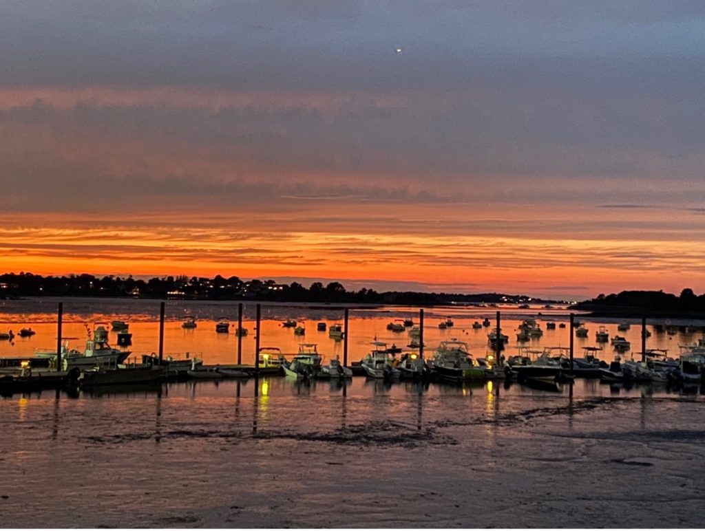
Hingham Harbor
Hingham Harbor offers a scenic and historically rich waterfront that has long played a central role in the town’s development. Nestled along Hingham Bay, the harbor features a sweeping coastline, dotted with protected coves, tidal estuaries, and small islands. Historically, Hingham Harbor was a vital hub for shipbuilding and maritime trade. In the 17th and 18th centuries, it supported a thriving fishing and coastal shipping industry, as well as local shipyards that built sloops, schooners, and brigs for regional commerce. In the 19th century, the waterfront continued to serve as a center of industry and transportation. Ferries and packet boats carried goods and people to Boston, while ice harvesting, saltworks, and warehousing supported the local economy. Later, with the rise of railroads and automobiles, commercial maritime activity declined, and the harbor gradually transitioned to more recreational uses.
Today, Hingham Harbor is known for its picturesque beauty, public access, and vibrant community life. The waterfront features Hingham Harbor Park, Bathing Beach, and the town’s public boat ramp and mooring field, as well as scenic trails, and picnic areas. The harbor is also home to the Hingham Maritime Center and is a popular spot for kayaking, sailing, and wildlife observation. Hingham Harbor remains a cherished community space that blends natural beauty, maritime heritage, and public recreation, offering residents and visitors a glimpse into both the town’s history and its continued connection to the sea.
Harbor Islands
There are four islands in the Hingham Harbor which are part of the Boston Harbor Islands National and State Park and are accessible to the public via small watercraft; Sarah, Langly, Ragged, and Button. Sarah Island is a roughly four-acre rocky outcrop which supports nesting colonies of gulls, black-crowned night herons, cormorants, and snowy egrets. This island is best appreciated from offshore to keep from disturbing the nesting birds. Langley Island is approximately four acres with towering rock cliffs on its north side and small beaches to the south and east. Vegetation includes oak, maple, huckleberry, viburnum, and brambles, with informal trails leading to scenic overlooks. Ragged Island was once part of a late 19 th century summer resort with restaurants and observation shelters and today is unmanaged and largely overgrown with poison ivy and greenbrier, making inland exploration difficult. Button Island is less than one acre and hosts a large oak tree and low-profile shrubs like bayberry and sumac and is a nesting ground for the increasingly rare American Oystercatcher. These islands have also served as seasonal stops for Native Americans and later became privately owned land parcels by colonial settlers. While none have visitor facilities, they provide a quiet, undeveloped glimpse into Boston Harbor’s glacial geography, wildlife habitat, and early colonial history, offering beautiful vistas toward Hingham and Boston.
Making a Difference
Hingham’s abundance of open spaces, spanning forests, meadows, coastlines, and islands, are the result of decades of thoughtful conservation, civic dedication, and community pride. From the vast trails of Wompatuck and the sweeping vistas of World’s End to the tranquility of smaller protected parcels, each piece contributes to a larger mosaic that defines the town’s character and enhances quality of life. These spaces connect residents not only to nature, but to Hingham’s rich history and enduring commitment to stewardship. As the town looks to the future, continuing efforts to protect, connect, and restore these spaces will be essential, not just for recreation or scenic beauty, but for sustaining the natural systems and cultural heritage that make Hingham special.
Everyone can make a difference; start by getting out and enjoying these properties more and by letting community leaders know how much you value open spaces. Other ideas are looking for ways to help with implementation of the recommendations in the Comprehensive Trails Plan, consider filling out the Hingham Talent Bank Application today to join a town committee like the Hingham Conservation Commission, Harbor Development Committee, Bare Cove Park Committee, or the Wier River Estuary Park Committee, or offer to volunteer with the HLCT.
Wonderful article! Thank you.
One way anyone interested can help advance/perpetuate the protection of the Nature of ALL of Massachusetts is so add your signature to support a ballot initiative driven by Mass Audubon and dozens of collaborative conservation partners. If we succeed, there will be a question on the state ballot next November asking whether we should have all revenue from the sales tax on sporting goods be specifically designated for all types of conservation efforts across the Commonwealth. How awesome would THAT be? Texas and other states are already doing that…if they can, so can we!
I am a Hingham resident and working hard to collect as many signatures as possible before mid-November. Please email me if you’re a registered Hingham voter and would like to sign! I will also be at the No Kings Protest at the Harbor tomorrow morning!